Know Your Motherland – Gangabal
Lake
By Maharaj
Krishen Raina
Milchar
Nov-Dec 2011
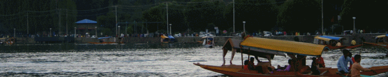
Photo
Courtesy: Wangnooheritagetours
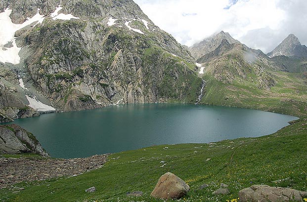
Gangabal Lake
(Lat: 34.4333, Long: 74.925) is situated at the foot of the north-eastern
glacier of Mount Harmukh, at an altitude of about 3570 Meters (Francis Brunel,
the author of ‘Kashmir’ puts the altitude at 3657 Meters). It is said to be
the true source of Kashmir Ganga and is hence known as ‘Uttarganga’. It is
the final goal of great ‘Haramuktaganga’ pilgrimage. Lake’s turquoise
coloured sheet of water lends a subtle charm to the valley which is known as the
‘Hardwar of Kashmir’.
Water from
glaciers collects into the Gangabal Lake, which subsequently flows down to
another lake nearby called Nundkol (Lat: 34.4166, Long: 74.9333) and then into
the Sindh River at Kangan. Gangabal is the most enchanting trekking destination
in the entire Kashmir valley and can be reached from Sonamarg via Kishansar and
Vishansar (about 4 days trek), from Kangan via Wangath and Narain Naag (1 day
trek), and from Chattergul via Mahalish and Brahmasar (1-2 days trek). Most
difficult part of the trek, when going via Narain Naag is Buth Sher, which is
very steep and difficult to climb.
Trekking routes
to Gangabal are open from July to October. For rest of the year, the area is
covered with very thick layer of snow, making it inaccessible. Gangabal Lake is
famous for rainbow trout fishing. The fishing season is from March to October.
The trekking
route from Sonamarg across Nichinai pass meanders along a number of lakes namely
Kishansar, Vishansar, Yamsar, Gadasar, Satsar and Nundkol. Kishansar, Vishansar
and Nundkol lakes are also stocked with trout fish.
Since ancient
times, the Gangabal trek has been the most sacred pilgrimage of Hindus.
An annual fair is held here in the third week of August. However post
eruption of militancy in 1990, the route was closed by the government to stop
infiltration and exfiltration into and out of the Valley. Kalhana Pandit has
mentioned in Rajatarangini that the Gangabal trail had been used in ancient
times by many Kashmiri rebels including famous King Bhoja to take shelter in the
Dard area of Gurez and Tilel.
Gangabal Lake is
2.70 Kms. Long and about 1.00 Km at the widest point. It is in the shape of
Shivas foot. Maximum depth of the lake is 83 Mtrs. Nundkol is 1.25 Kms long and
about 400 Meters at the widest point.
There are a
number of peaks atop Mount Harmukh. The ancient name of the peaks is Haramukta.
Hindus believe that these peaks are the abode of Lord Shiva. A Kashmiri
tradition stoutly maintains that human feet can never touch the Harmukh summit.
It is said when Sir Aurel Stein scaled the peaks along with some Kashmiri Muslim
coolies in 1894, he experienced great difficulty in convincing his Brahman
friends, who just would not believe. The argument they offered was simple; if
anybody scaled the peaks, then it cannot be Haramukta. Sir Aurel Stein says that
on reaching the top, one gets confused as there are many similar summits and it
is difficult to tell which one is the real top?
References
Source: Milchar
|