|


|
 |
|
 |
 |
 |
 |
Situation,
Location, Area and Extent
The
territories of Jammu, Kashmir, Ladakh and Gilgit
form the State of Jammu and Kashmir. The state of
Jammu and Kashmir, which had earlier been under
Hindu rulers and Muslim sultans, became part of the
Mughal Empire under Akbar from 1586. After a period
of Afgan rule from l756, it was annexed to the Sikh
Kingdom of Punjab in 1819. In 1820 Maharaja Ranjit
Singh made over the territory of Jammu to Gulab
Singh. In 1846 Kashmir was also made over to Gulab
Singh under the Treaty of Amritsar. Ladakh was
annexed by Maharaja Gulab Singh in 1830. Thus this
northernmost state was founded by Maharaja Gulab
Singh in 1846 and was the biggest princely state in
India before the partition of the country in August
1947. At that time the total area of the state was
2,22,236 sq. km. Pakistan invaded the State in
October 1947. Indian forces pushed Pakistan back but
in 1949 when a cease fire line was drawn about one
third of the area i.e. 78932 sq. km. i.e. the whole
of Gilgit, Mirpur, Kotli and a part of Poonch came
into the possession of Pakistan, leaving behind only
143,30 sq. km. on the Indian side. Jammu, Udhampur,
Kathua and Anantnag districts remained unaffected.
Again in 1962 China occupied about 64000 sq. kms. in
Ladakh known as Aksai Chin. Pakistan again made an
unlawful possession over Chhamb, Deva, Chakla and
Manawar gaining an area of3999 sq. kms. Thus total
area left on the Indian side is about 12850 sq. kms.
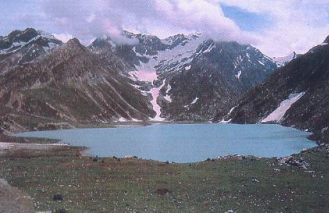
There
are many low lying valleys in the state like Tawi
Valley, Chenab Valley, Poonch Valley, Sind Valley
and Liddar Valley, but the main Valley is the valley
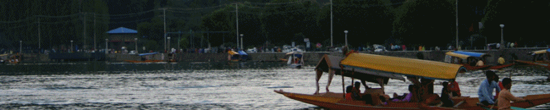
of Kashmir, which is 100 kms. wide and 15520.3 sq.
kms. in area. Through this velley flows the river
Jhelum with its tributaries. The height of the
valley above sea level is about 1700 metres.
On
the map
of India, the State of Jammu and Kashmir looks
like a crown. The state is 640 kms. in length from
north to south and 480 kms. form east to west. To
its north lie Chinese and Russian Turkistan. On its
east is Chinese Tibet. On the South and South-West
lie the states of Punjab and Himachal Pradesh. On
the west is the North West Frontier Provinces
ofPakistan, China and Russia. Afghanistan and
Pakistan now have come close to the boundaries of
the state of Jammu and Kashmir, The nearness to the
boundaries of foreign countries has made the
position of the State most important from military
point of view.
The
entire State lies between 32.17" and
36.58" North altitude and East to West, the
State lies between 73.26" and 80.30"
longitude. The standared time is 5.30 hours ahead of
Greenwitch time as in the rest of India and has a
difference of half an hour with the local time. In
lalitude, the State of Jammu and Kashmir corresponds
with South Carolina (North America), Fez (Morracco),
Damascus, Baghdad and Peshawar (Pakistan).
|
|
 |
 |
 |
 |
|
|