The Geology of the territories of Jammu, Kashmir and Ladakh have been studied in some detail by R.
Lydekkar. He has divided the territory into three different structural Zones:
1. The Panjal
2. The Zanskar
3. The Tertiary Groups
These three Geological
divisions form the basis of the four physical divisions of the State.
The Panjal forms the Outer
plain, the Outer Hills and the Middle Mountains. The Zankar includes the whole
of the eastern region from Spiti and Lahol (32.170N. Latitude) to the lofty
Karakoram mountains in the north. The Tertiary Groups include the valley of
Kashmir and other river Valleys.
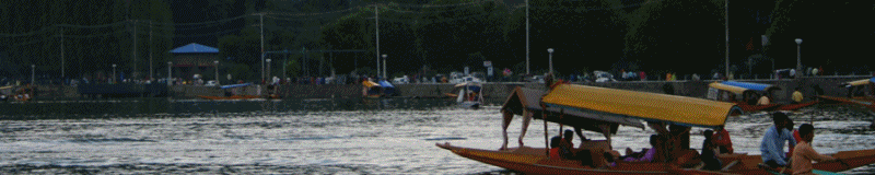
The oval valley of Kashmir
is longitudinal. It is about 1700 metres above sea level. There is a high wall
of mountains round the valley. These rise to a height of 5500 metres above sea
level. The only outlet of the valley is Baramulla where the Jehlum flows out
through a narrow gorge. The entire drainage of the valley of Kashmir and its
surrounding areas have only this outlet. In the north, Kashmir has many volcanic
rock formations. These are mostly stratified and several thousand metres thick.
There are many layers of sedimentary rocks which are found in Liddar valley,
Baramulla, district and Banihal Verinag section of the Pir Panjal range.
Limestones and shells are common. The rock layers have many fossils. Near
Yarkand to the extreme north, shells have been found showing that the region was
under sea in the geological past.
To the south and west
of the valley there are karewa formations which are lake-laid clays and shales.
These are lacustine deposits and appear like flat mounds on the margin of high
mountains. Below these karewas is spread the alluvium of the Jehlum. The highest
karewa is near the Pir Panjal. It is 3800 meters above sea level and more than
2100 metres above the level of the Jhelum.